A hailstorm "quenched" the flames of high temperatures this Tuesday in the municipality of Guanajay, Artemisa, which reported intense rainfall around 3:15 PM accompanied by small ice "pellets."
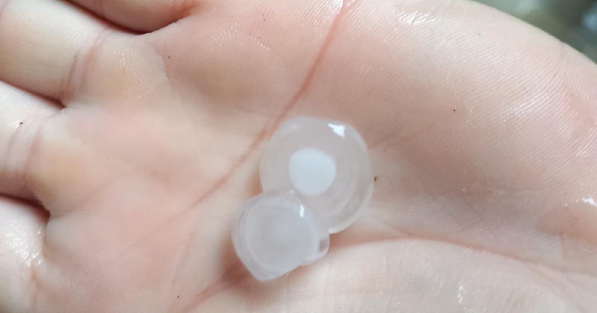
According to the Forecast Center of the Cuba Institute of Meteorology (Insmet), "the hailstones vary in size, ranging from a pea to approximately 1.5 centimeters in diameter... the hailstorm was accompanied by heavy rain, but no lightning was heard."
This type of solid precipitation formed by balls or pieces of ice is the second occurrence in this Artemisa territory in 2024. A similar event was experienced last March, comparable to other cities worldwide due to the abundance of hailstones that filled yards, streets, and highways.
Unlike the previous phenomenon, which caused damage to buildings and energy infrastructures, this time there were no lightning strikes, and so far, no economic damages have been reported.
However, reports of hailstorms are becoming more frequent on the island, such as the one registered at the beginning of May when Insmet reported a severe storm affecting the province of Ciego de Ávila.
Widespread Severe Weather Across Cuba
This is a consequence of worsening weather conditions across the national territory. Over the past 24 hours, numerous rains and severe local storms have characterized provinces such as Matanzas, Villa Clara, Ciego de Ávila, Sancti Spíritus, and Las Tunas, where hail of various sizes was detected.
The most affected areas included the communities of Iguará and Venegas in the municipality of Yaguajay, Sancti Spíritus, according to information provided to the Escambray newspaper by the local party secretary, Mileydi Milián Barnés.
Preliminary data revealed that the meteorological phenomenon caused power grid disruptions and roof collapses at the Mérida Cheese Factory, the Pig Unit, Venegas livestock dairies, and residents' homes.
Precipitation recorded there reached 11.2 millimeters by 6:00 PM on Monday, associated with a trough passing through the territory at mid and high atmospheric levels, combined with hail and strong winds (86 km/h), explained Yusmani Mesa, a specialist from the Provincial Meteorological Center's forecast group.
Such climatic systems test the regime's response capability to meteorological events, which, from June 1 to November 30, will face an active hurricane season. It is anticipated that around 20 tropical cyclones will form in the North Atlantic basin, with 11 potentially reaching hurricane status.
Understanding Hailstorms and Severe Weather in Cuba
To provide more insights into the hailstorms and severe weather affecting Cuba, here are some frequently asked questions and their answers.
What causes hailstorms to occur in Cuba?
Hailstorms in Cuba occur due to the combination of atmospheric instability, strong updrafts, and the presence of supercooled water droplets in the clouds, which freeze into ice pellets.
How often do hailstorms happen in Cuba?
Hailstorms are relatively rare in Cuba but have become more frequent in recent years, possibly due to changing climatic conditions.
What precautions should be taken during a hailstorm?
During a hailstorm, individuals should seek shelter indoors, avoid being near windows, and protect vehicles and property from potential damage.
How does the Cuban government respond to severe weather events?
The Cuban government monitors severe weather events through agencies like Insmet and takes measures to mitigate damage, though the effectiveness of these responses is often questioned.