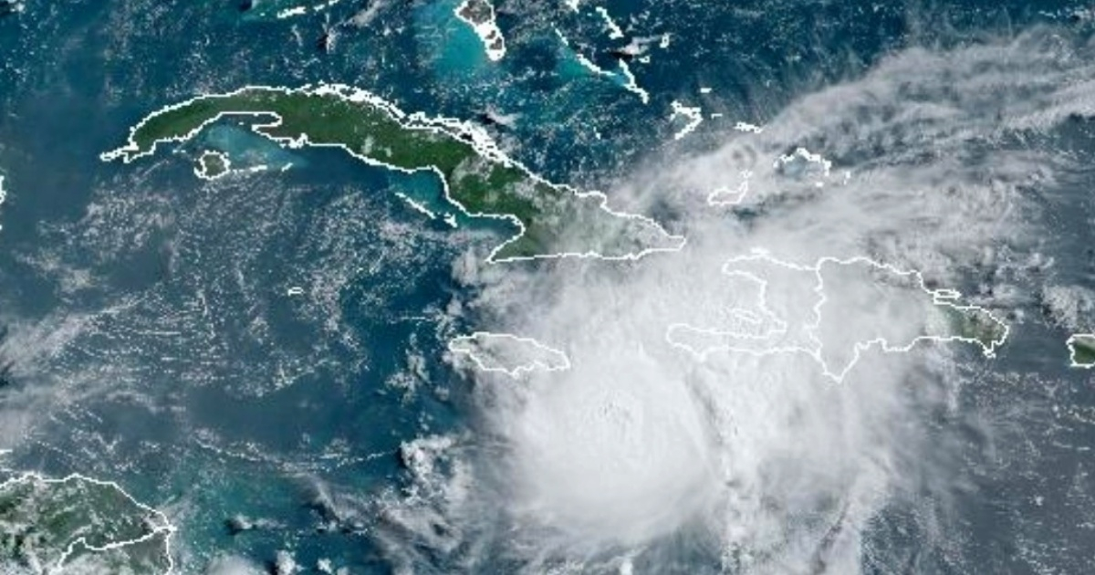
The Institute of Meteorology (INSMET) has issued a warning about the imminent deterioration of weather conditions in eastern Cuba due to the approach of Hurricane Beryl. These conditions include strong winds, heavy rains, and significant swells that could cause coastal flooding ranging from mild to moderate.
Tropical Cyclone Alert
“As Beryl moves across the southern seas of eastern Cuba, there will be an increase in wind speeds in the eastern region, which this afternoon could reach sustained speeds between 40 and 55 kilometers per hour with higher gusts in the southern part of Granma,” explained INSMET in their Tropical Cyclone Alert No. 8, issued at 6 a.m. this Wednesday. The top meteorological agency clarified that in the rest of the eastern region, winds will range between 20 and 35 km/h, with higher gusts.
Starting from early Thursday morning and continuing into the early hours of July 4th, winds could also be felt in Isla de la Juventud and the westernmost part of the country, with speeds between 30 and 45 km/h, along with stronger gusts.
Regarding rainfall, the eastern region will experience predominantly cloudy skies with showers, rain, and some thunderstorms, which could be intense in certain areas, especially in mountainous regions.
By late this afternoon and evening, some rain could also occur in the southern part of the central region “due to the circulation of the outermost bands associated with this cyclonic system, where heavy rain cannot be ruled out.”
Coastal Flooding Risks
The proximity of Beryl will also generate strong swells with coastal flooding in the southern parts of Granma and Santiago de Cuba. Swells will increase to significant levels by the afternoon in southern Granma and the coastal area of Guamá municipality in Santiago de Cuba, causing coastal flooding from mild to moderate.
“These swells will extend from early Thursday morning to the southern central region and later to the western region by that morning, becoming strong in the south of Isla de la Juventud, the Canarreos archipelago, and the westernmost part of Cuba, with mild to moderate coastal flooding in low-lying areas of this coastline,” concluded INSMET.
In its latest bulletin, the National Hurricane Center (NHC) in Miami reported that Beryl, now a Category 4 hurricane, is very close to Jamaica. The system, which has slightly weakened in recent hours, has winds of 230 km/h and is moving west-northwest at a speed of 31 km/h.
Hurricane Beryl also poses a significant threat to the Cayman Islands, which are expected to be impacted between tonight and Thursday. The National Hurricane Center has issued hurricane warnings for Jamaica, Grand Cayman, Little Cayman, and Cayman Brac. Additionally, there are hurricane watches in effect for the southern coast of Haiti and the eastern coast of the Yucatán Peninsula, as well as tropical storm warnings for the southern coast of the Dominican Republic and Haiti. A tropical storm watch has also been issued for the coast of Belize from the south of Chetumal to Belize City.
Beryl is expected to maintain its hurricane strength as it passes near Jamaica and the Cayman Islands, although it is likely to weaken slightly in the coming days.
FAQs about Hurricane Beryl's Impact on Cuba
Below are some frequently asked questions and their answers regarding the impact of Hurricane Beryl on Cuba and the surrounding regions.
What areas in Cuba are most affected by Hurricane Beryl?
The eastern region, including Granma and Santiago de Cuba, is expected to be most affected by Hurricane Beryl, with strong winds, heavy rains, and coastal flooding.
What are the expected wind speeds in eastern Cuba due to Beryl?
Wind speeds in eastern Cuba could reach sustained speeds between 40 and 55 km/h with higher gusts, particularly in southern Granma.
Will other regions of Cuba be affected by Hurricane Beryl?
Yes, winds and rains could also affect Isla de la Juventud and the westernmost parts of Cuba, with wind speeds between 30 and 45 km/h and possible coastal flooding in low-lying areas.
