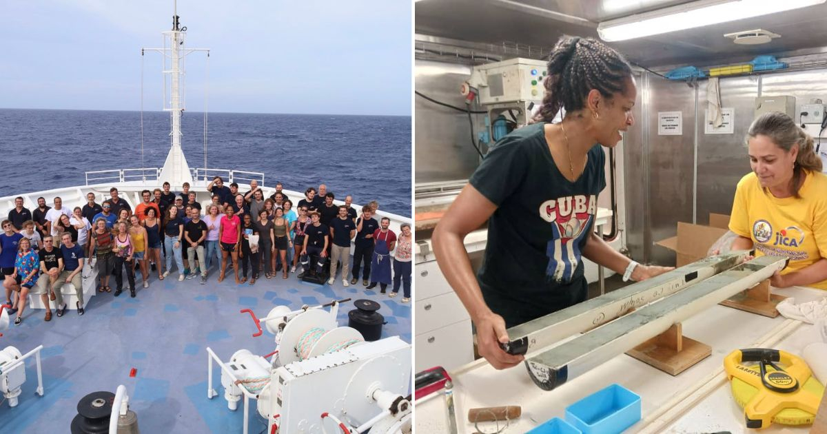
Specialists from six countries, including Cuban experts, are participating in a scientific expedition in the Caribbean, focusing on the highly seismic northern zone of Santiago de Cuba, with research extending until August. The oceanographic fleet Pourquoi-Pas? (Why Not?), belonging to the French research institute Ifremer and the French Navy, began its journey last June as part of the marine research project Haiti-Twist, according to the official newspaper Granma.
In this expedition, researchers from Cuba, France, Belgium, Germany, Haiti, and the United States are determining geophysical parameters and utilizing equipment to obtain precise records of potential faults. The objective is to analyze the risks of the active twin fault system located on the northern edge of the Caribbean tectonic plate. Additionally, they plan to recover seismometers installed on the ocean floor.
Scientific Goals and Methods
Dr. Bladimir Moreno Toirán, a specialist at the National Center for Seismological Research (CENAIS) in Santiago de Cuba, detailed that the marine expedition aims to “characterize the behavior and movement of the tectonic fault and determine the thermal state and the influence of fluids in the fault rupture process.” Moreover, the expedition also seeks to investigate the tectonic history and the structure of the crust and mantle in the region.
He noted that during the campaign, various geophysical measurements will be conducted. These include multichannel reflection seismics and wide-angle seismics, using seismometers deployed on the seabed. CENAIS specified on the social network X that the Cuban institution is already in the “processing of the valuable information collected during the expedition.”
“The Pourquoi pas? In Cuban waters, conducting core extraction up to 3,000 meters deep, penetrating south of Santiago de Cuba, up to 10.5 meters of sediment thickness,” the scientific center indicated in another post. Additionally, CENAIS mentioned on X that processing the cores extracted south of Cuba would enable scientists, including those from CENAIS, to make informed decisions.
The Oriente geological fault, the main area of seismic activity and constituted by a plate boundary south of the eastern region of Cuba, recorded the highest number of earthquakes on the island last year, reported EFE. According to the annual summary from CENAIS, the Caribbean nation registered 7,475 seismic events in 2023, of which 14 were perceptible. The magnitudes of the movements ranged from less than 3 to up to 5.9 on the Richter scale.
Recently, CENAIS presented a map compiling the epicenters of earthquakes detected by the Cuban seismological station network from January 1998 to February 2024, highlighting the areas with the highest density and probability of seismic activity in a seismically active country. The study was analyzed on the portal of the Cuban Network of Science (Redcien) by two local experts, Enrique Arango Arias and Manuel A. Iturralde Vinent, who emphasized that despite their low magnitude and low perceptibility, continuous monitoring is crucial as they can cause fractures in rigid structures, leading to more severe problems over time.
In 2023, the same institution created an unprecedented map indicating tsunami hazard zones along the coasts of Cuba. Granma reported that the map was presented during the XI International Congress on Disasters and the VII International Conference of Firefighters, events held at the Palace of Conventions in Havana.
Understanding Seismic Risks in Santiago de Cuba
The following questions and answers provide insights into the seismic research being conducted in the northern zone of Santiago de Cuba, the potential risks, and the scientific methods used.
What is the main objective of the seismic expedition in Santiago de Cuba?
The main objective is to analyze the risks associated with the active twin fault system on the northern edge of the Caribbean tectonic plate and to recover seismometers installed on the ocean floor.
Which countries are participating in the seismic research expedition?
Researchers from Cuba, France, Belgium, Germany, Haiti, and the United States are participating in the expedition.
What scientific methods are being used during the expedition?
The expedition uses various geophysical measurements, including multichannel reflection seismics and wide-angle seismics, with seismometers deployed on the seabed.
How many seismic events were recorded in Cuba in 2023?
Cuba recorded 7,475 seismic events in 2023, with 14 being perceptible. The magnitudes ranged from less than 3 to up to 5.9 on the Richter scale.