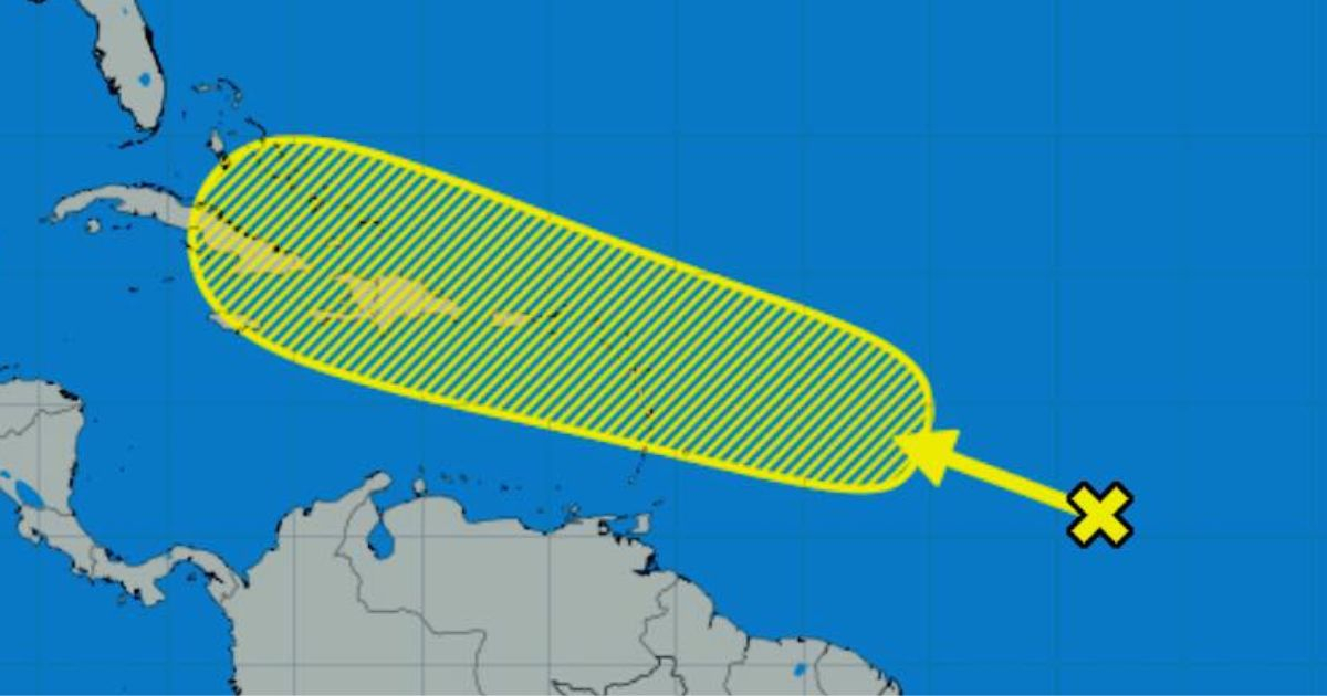
The National Hurricane Center (NHC) has started tracking a new atmospheric disturbance over the Tropical Atlantic. Cuban meteorologist Raydel Ruisánchez mentioned on Facebook that "so far, the chances of a tropical cyclone forming are low."
However, he warned that "some cyclonic development could occur as this system moves westward over the coming week." Regarding forecast models, he noted that the "European models have been quite consistent in this situation over the past few days, while the American model only shows an area of bad weather moving through the Caribbean."
The specialist emphasized that "we will be monitoring this situation and any possible changes," and cautioned that August is approaching, "when the hurricane season really starts to ramp up," he stated.
Ruisánchez recently remarked that Saharan dust would play a crucial role in keeping the tropics calm for a while. This phenomenon, which occurs more frequently from late June to mid-August, involves waves of Saharan dust crossing the Atlantic and even reaching the Gulf of Mexico, explained the specialist on his Facebook account.
"While the Saharan Air Layer is keeping cyclonic activity at bay at the moment, we must be prepared for a potential increase in tropical cyclones once these concentrations decrease in August and September," the specialist warned.
Regarding the intense hurricane season forecast, the meteorologist cited Colorado State University, which recently updated its prediction to 25 named storms, 12 hurricanes, and 6 major hurricanes, including those already formed. Additionally, the university highlighted a 67% chance that a major hurricane could impact Cuban territory, he emphasized.
Monitoring Atlantic Disturbances: Key Questions and Answers
As the National Hurricane Center begins to monitor a new disturbance in the Atlantic, many are curious about the implications and potential developments. Here are some key questions and answers to help you understand the situation better.
What is the current status of the disturbance in the Atlantic?
The National Hurricane Center is currently monitoring the disturbance, which has a low potential for cyclonic development at this time.
How reliable are the forecast models for this disturbance?
European models have shown consistency in predicting this situation over the past few days, while the American model has indicated only an area of bad weather moving through the Caribbean.
What role does Saharan dust play in tropical cyclone activity?
Saharan dust helps keep cyclonic activity low by stabilizing the atmosphere. This phenomenon is most common from late June to mid-August.
What are the predictions for this year's hurricane season?
Colorado State University has updated its forecast to include 25 named storms, 12 hurricanes, and 6 major hurricanes. There is also a 67% chance that a major hurricane could impact Cuba.