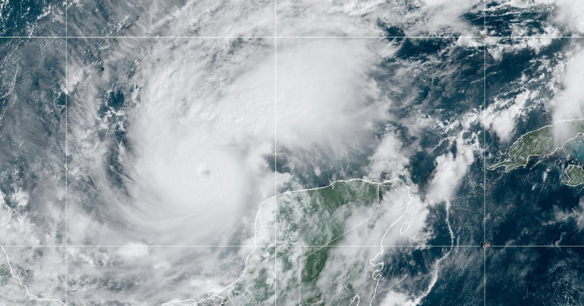
The National Hurricane Center (NHC) announced on Monday that Hurricane Milton has escalated to a Category 5 storm, boasting maximum sustained winds of 160 mph (250 km/h) and even stronger gusts as it moves toward Florida. The monitoring center shared on social media platform X that the latest hurricane reconnaissance findings from the 53rd Weather Reconnaissance Squadron (@53rdWRS) confirm this significant intensification.
Currently, Hurricane Milton is situated 118 miles west-northwest of Celestún and 149 miles west of Progreso, both in Mexico's Yucatán state, and approximately 743 miles west-southwest of Tampa, Florida, following its projected path. The tropical cyclone is advancing east-southeast at a pace of 8 mph and is anticipated to travel near or just north of the Yucatán Peninsula on Monday and Tuesday. It is expected to cross the eastern Gulf of Mexico and approach Florida’s west coast by Wednesday.
Threat to Florida's West Coast
The formidable hurricane poses a severe storm surge threat to Tampa Bay, prompting evacuation orders and heightened urgency in cleanup efforts following Hurricane Helene, which inundated the same coastal area less than two weeks ago. According to the Associated Press, cited by 7 News Miami, a hurricane warning has been issued for parts of Yucatán, while much of Florida's west coast and Lake Okeechobee are under hurricane and storm surge watches.
The core of Hurricane Milton could strike Tampa Bay on Wednesday and maintain hurricane strength as it traverses central Florida toward the Atlantic, largely sparing states previously impacted by Helene, which resulted in at least 230 fatalities from Florida to the Appalachians.
Potential Impact on Cuba
Although Hurricane Milton, a Category 5 on the Saffir-Simpson scale, continues to strengthen in the Gulf of Mexico en route to Florida, its effects might be felt in Cuba’s westernmost provinces starting Monday night, according to the latest meteorological reports. Authorities have issued alerts for the region, anticipating tropical storm-force winds to impact areas like Pinar del Río, Artemisa, and Havana.
The NHC projects that strong winds, exceeding 39 mph, could reach the western tip of Cuba by 8:00 PM Monday, intensifying overnight into Tuesday. This area faces a 20% to 30% chance of experiencing these winds, posing a moderate risk to infrastructure and residents’ safety.
Meteorologists have warned of a potential storm surge reaching 8 to 12 feet in Tampa Bay, with heavy rainfall accumulating 5 to 10 inches across mainland Florida and the Keys, possibly leading to flash floods and river flooding, with some areas receiving up to 15 inches of rain, as reported by AP.