The Cuban Meteorological Institute (Insmet) issued a tropical cyclone alert this Monday afternoon as Hurricane Milton escalated into a formidable and hazardous Category 5 storm, the highest level on the Saffir-Simpson scale. As it barrels through the Gulf of Mexico, it draws nearer to Florida.
According to Insmet, "winds from the south to southwest are expected to develop this afternoon, with speeds ranging from 15 to 30 kilometers per hour in western Cuba." Moreover, they predict that "tomorrow, sustained wind strength will increase from Pinar del Río to Mayabeque, reaching speeds between 25 and 40 kilometers per hour, and up to 50 kilometers per hour, with stronger gusts in Pinar del Río by late afternoon."
The organization also forecasted that starting tonight, waves will begin affecting the southern coast of western Cuba, gradually intensifying into swells on the southern shores of Isla de la Juventud and Pinar del Río by early Tuesday morning.
Coastal flooding is likely from tomorrow along the southern coast from Pinar del Río to Mayabeque, including the Isla de la Juventud. "Swells and coastal flooding will begin Wednesday on the northern coast, including the Havana Malecón," they indicated.
For the rest of Monday, "conditions will be conducive to rainfall throughout the country, especially in the interior and on the northern coast during the afternoon."
Anticipated Weather Impact
"The broad circulation of Hurricane Milton, along with its associated feeder bands, will maintain instability in the west with showers and rain starting late tonight," they commented.
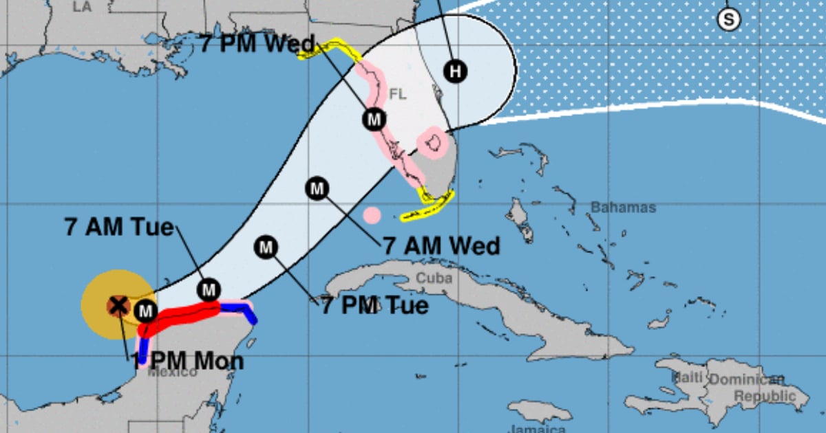
Finally, they noted that this hurricane "continues its slow movement towards the east-southeast over the Gulf of Mexico."
"Over the next 12 to 24 hours, this hurricane will maintain a similar path, veering eastward, moving very close to or over the Yucatán Peninsula. Current forecast models suggest that tomorrow, the hurricane will shift its course to the northeast, increasing its speed as it approaches the western coast of the Florida Peninsula by Wednesday evening," they observed.
Given its current position and anticipated path across the Gulf of Mexico towards the Florida Peninsula, the Prediction Center will closely monitor its progress in the coming days.