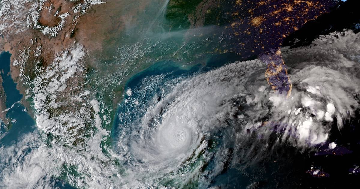
Hurricane Milton, a formidable weather system fluctuating between Categories 4 and 5 on the Saffir-Simpson scale, has been vividly captured by the International Space Station (ISS), showcasing its immense power over the Gulf of Mexico.
On Tuesday morning, the ISS's external cameras recorded breathtaking footage of the massive storm, with wind speeds reaching 175 miles per hour (280 km/h), as it made its way through the Gulf towards Florida's west coast. The shared video clearly reveals the storm's eye, surrounded by thick cloud bands sprawling over the region.
Milton experienced rapid intensification between Sunday and Monday, reaching Category 5, the highest level on the Saffir-Simpson scale, as it progressed across the Gulf of Mexico towards Florida. By Tuesday morning, however, it had weakened slightly to Category 4, yet still poses a substantial threat to lives and property along Florida's western coastline.
The U.S. National Hurricane Center (NHC) reported that the cyclone maintains sustained winds up to 155 mph (250 km/h), with even stronger gusts. Additionally, the Miami Weather Service has issued warnings about the powerful winds, heavy rainfall, and storm surges expected to impact the state.
Milton's barometric pressure has been recorded at 897 millibars (mb), ranking it as the fifth lowest pressure hurricane recorded in the Western Hemisphere. This statistic places it among the most potent hurricanes in history, nearing the theoretical intensity limit of such phenomena, according to a study from MIT. Telemundo Chicago describes Milton as "nearly at the edge of what the Earth's atmosphere can produce."