Heavy showers, rain, and thunderstorms are affecting the western and central regions of Cuba this Thursday, with expectations that these conditions will persist into Friday. This meteorological activity is attributed to a cold front hovering over the Florida Straits, near the western tip of the island, as reported by Cuba's Institute of Meteorology (Insmet).
According to Insmet, the combination of a cold front or frontal trough over the Florida Straits, a broad low-pressure center in the western Caribbean Sea, a tropical wave, and other atmospheric factors are creating significant instability. Such conditions are highly conducive to the occurrence of showers, rain, and thunderstorms, as noted in their recent social media update.
Weather Conditions Set to Persist
The statement further clarified that these weather conditions are expected to continue into the following day, particularly in the western and central regions, with a notable increase in wind strength anticipated, especially along the northern coast.
The Insmet Forecast Center has provided comprehensive details regarding the weather expected on Friday. It reports that the western and central parts of the country will experience mostly cloudy skies, with showers, rain, and isolated thunderstorms, especially along the northern coastline for much of the day. In the interior and southern areas of these regions, some showers and rain are expected in the afternoon. Meanwhile, the eastern part of the country will see partly cloudy skies, with overcast conditions and isolated rainfall in some locations.
Temperature and Wind Predictions
Minimum temperatures are predicted to range between 21°C and 24°C, with cooler temperatures in the interior regions and warmer conditions along the coast. Maximum temperatures will vary between 28°C and 31°C in the western half, reaching up to 34°C in the rest of the country.
Northeast winds are expected to blow at speeds between 10 and 25 kilometers per hour, reaching up to 35 km/h in northern coastal areas of the west and center, where stronger gusts may occur.
Coastal Impacts and Flooding Risks
Persistent swells are forecasted along the northern coast of the west, potentially causing slight water accumulations in low-lying areas, including Havana's iconic Malecón. There will also be moderate surf along the central and eastern northern coasts, with minimal wave activity along the entire southern coast, except for Guanahacabibes and the Isle of Youth, where moderate swells are expected.
In their closing forecast, the Prediction Center warned that in areas experiencing showers and rain, wind speeds and wave heights could increase significantly.
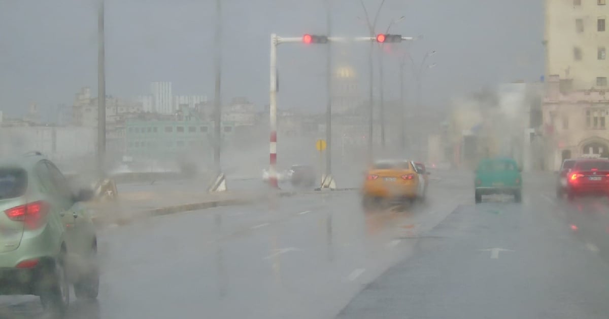
Since the early hours of Thursday, Havana has been battered by intense rain, resulting in flooding across various parts of the Cuban capital, particularly in low-lying areas with poor drainage systems.
The current atmospheric conditions, driven by the stationary cold front and the trough in the Gulf of Mexico, maintain a high likelihood of heavy rain throughout much of the country, with the west being the most affected area. The risk of flooding remains significantly elevated.
As of 9:30 a.m., locations such as San José de las Lajas, Jaruco, and Catalina de Güines had recorded over two inches of rain (50 mm) within just three hours. In Havana, the Casablanca meteorological station reported an accumulation of 42.9 mm of rainfall from the early morning hours up to 8:00 a.m.