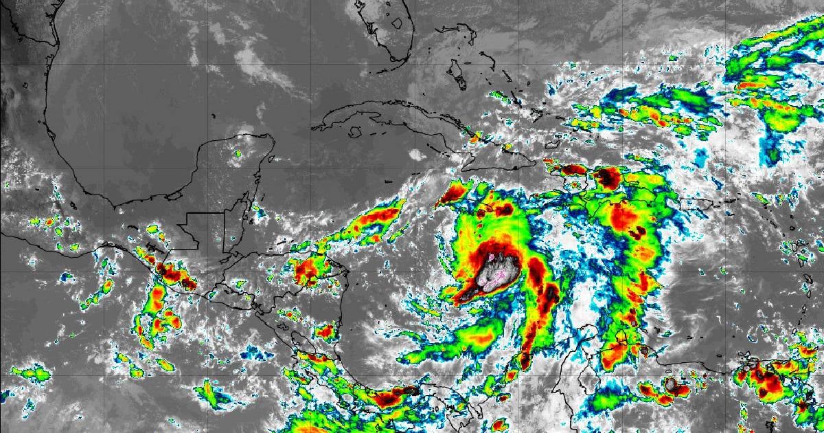
The Forecast Center of the Institute of Meteorology (INSMET) has issued Tropical Cyclone Advisory No. 2, highlighting the emergence of Tropical Storm (TT) Rafael in the Caribbean Sea. This advisory stresses the importance of taking necessary precautions due to the potential threat the storm poses to the island.
INSMET's report underscores the rapid development of what was previously Tropical Depression Eighteen. "The maximum sustained winds have increased to 75 kilometers per hour, with higher gusts, and the central minimum pressure has dropped to 997 hectoPascal," the report stated.
Rafael's Current Position and Projected Path
As of 4:00 p.m., TT Rafael was located at 15.5 degrees latitude North and 76.7 degrees longitude West. This position places it approximately 280 kilometers south of Kingston, Jamaica, 635 kilometers southeast of Grand Cayman Island, and 920 kilometers southeast of Punta del Este, Isla de la Juventud.
Rafael is moving northward at a speed of 15 kilometers per hour, a trajectory expected to continue over the next 12 to 24 hours. As Rafael approaches Jamaica, it is predicted to shift northwestward. "As it moves, it is likely to gain more organization and intensity, potentially reaching hurricane status near the Cayman Islands," INSMET warned.
Impending Weather Conditions in Cuba
For the remainder of the day, Cuba can expect rain, showers, and thunderstorms in the eastern and central regions. These conditions may become severe and intense in certain areas. The precipitation is forecasted to spread to western Cuba later.
The impact of wind and sea conditions in various regions of the country will depend on the path and intensity of this tropical cyclone. INSMET emphasized the need to closely monitor the storm's progress, considering its current position and potential trajectory, as well as the potential impacts on national territory and ongoing updates from the institution.
