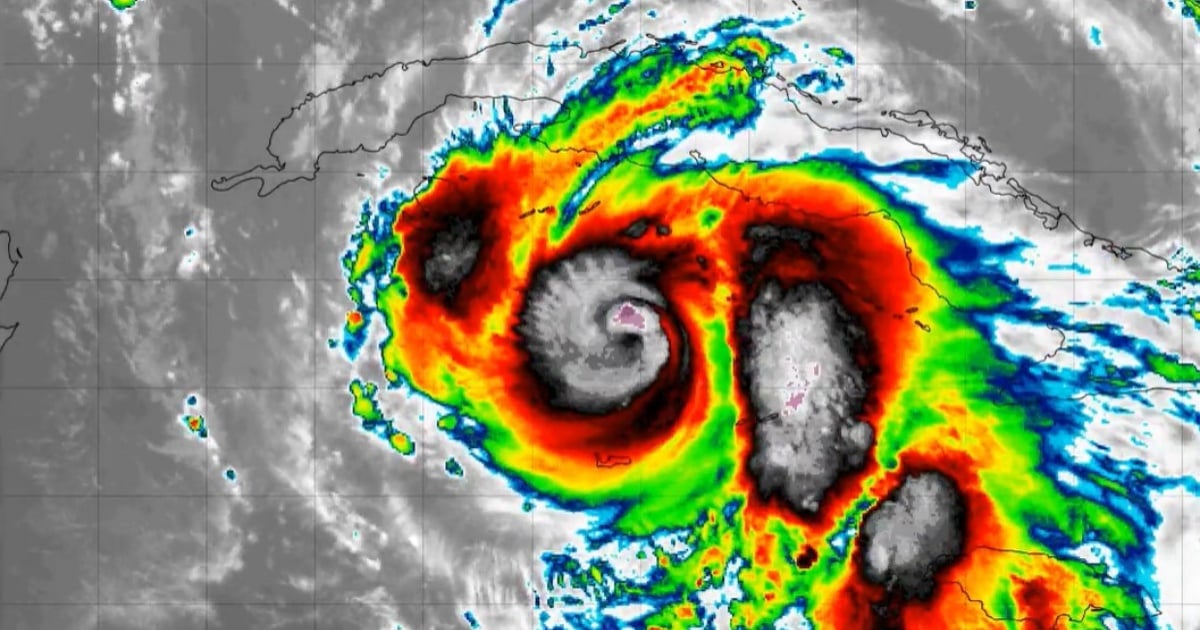
The hurricane known as Rafael is advancing northwestward and is anticipated to intensify to nearly a "major hurricane" status—equivalent to Category 3—as it approaches western Cuba. As of the latest advisory from the National Hurricane Center (NHC) issued at 4:00 a.m., Rafael was located approximately 190 km southeast of Isla de la Juventud and 310 km south-southeast of Havana.
Currently skirting the edge of Category 2, the hurricane boasts maximum sustained winds of 90 mph (150 km/h) and is moving northwest at a speed of 14 mph (22 km/h). It is expected to maintain this trajectory throughout the day, with a subsequent shift towards the west-northwest in the Gulf of Mexico.
There is potential for Rafael to rapidly strengthen and approach major hurricane status before making landfall in western Cuba today. It may weaken slightly as it traverses Cuba, but forecasts indicate it could regain intensity in the southeastern Gulf of Mexico. The cyclone's minimum central pressure is estimated at 970 millibars (28.65 inches), signaling a "well-organized system with potential for intensification," according to the NHC.
Current Alerts and Warnings
Hurricane Warning: Issued for the Cayman Islands and several Cuban provinces including Pinar del Río, Artemisa, Havana, Mayabeque, Matanzas, and Isla de la Juventud.
Tropical Storm Warning: In effect for Villa Clara, Cienfuegos, Sancti Spíritus, and Ciego de Ávila. Additionally, the warning extends to the Florida Keys, from Key West to the west of the Channel 5 Bridge, including the Dry Tortugas.
Tropical Storm Watch: Applies to Camagüey and Las Tunas.
Hurricane-force winds extend outward up to 30 km from the center, while tropical storm-force winds reach up to 165 km, impacting a significant area.
Potential Hazards for Affected Areas
Winds: Hurricane conditions are probable in the Cayman Islands imminently, with similar conditions expected in western Cuba and Isla de la Juventud today. Tropical storm conditions are anticipated in central-western Cuba and the Florida Keys through the day and night.
Rainfall: Rainfall accumulations of 4 to 7 inches (10 to 18 cm) are expected in the Cayman Islands and western Cuba, with isolated amounts reaching 10 inches (25 cm) in mountainous areas. These rains could trigger flash floods and landslides. Jamaica and the Florida Keys may see 1 to 3 inches (2.5 to 7.5 cm) of rain.
Storm Surge: Surge levels could raise sea levels between 1 to 3 feet (30 to 90 cm) above normal tide in the Cayman Islands tonight, and 8 to 12 feet (2.5 to 3.6 meters) along the southern coast of Cuba in areas under the hurricane warning, including Isla de la Juventud.
Tornadoes: There is a risk of tornadoes in the Florida Keys and southwest mainland Florida during the day.
Surf and Rip Currents: The western Caribbean and Gulf of Mexico are expected to experience rough surf, with dangerous rip currents posing a hazard.
