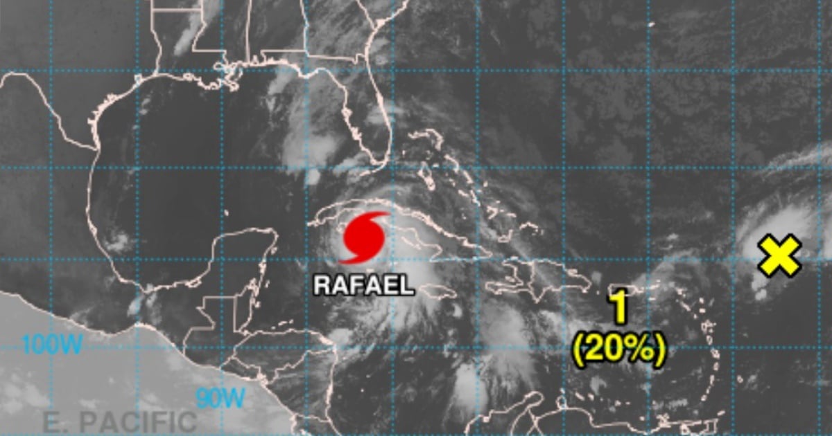
The Meteorological Institute (INSMET) has sounded an urgent alarm this Wednesday at 6:00 a.m. (local time), cautioning that weather conditions in Cuba are set to deteriorate rapidly in the coming hours. Throughout the night, heavy rains, showers, and thunderstorms have been recorded in the eastern and central parts of the country, with a significant increase anticipated in the western region.
These downpours are expected to persist over the next 24 hours, with rainfall totals ranging from 100 to 200 millimeters, potentially exceeding these amounts in certain areas. In the morning, winds will blow from the east to southeast in the west and central regions, reaching speeds between 50 and 65 km/h. By the afternoon, the wind direction will shift to southeast-south, with speeds escalating to 95 to 110 km/h and even stronger gusts. Near the center of this tropical system, hurricane-force winds are anticipated as it crosses the western region.
Escalating Winds and Coastal Threats
The south-central and western coasts are bracing for powerful swells, with moderate to severe coastal flooding expected in the southern areas of Sancti Spíritus, Cienfuegos, Matanzas, Mayabeque, Artemisa, and Pinar del Río, as well as in the Isle of Youth and the Canarreos Archipelago.
In a more recent update, INSMET disclosed that Rafael has reached Category 2 status. As of 7:00 a.m., the hurricane's eye was located 140 kilometers east-southeast of the Isle of Youth and 260 kilometers south-southeast of Havana, Cuba, with maximum sustained winds of 160 km/h, advancing northwest at 22 km/h. If the current trend of rapid intensification continues, Rafael could climb to Category 3 before making landfall.
Preparation Urged as Hurricane Approaches
Various Cuban meteorologists have taken to social media platforms to urge the western population to brace themselves for the impending impact. Rafael is projected to make landfall somewhere between Artemisa and Pinar del Río.
