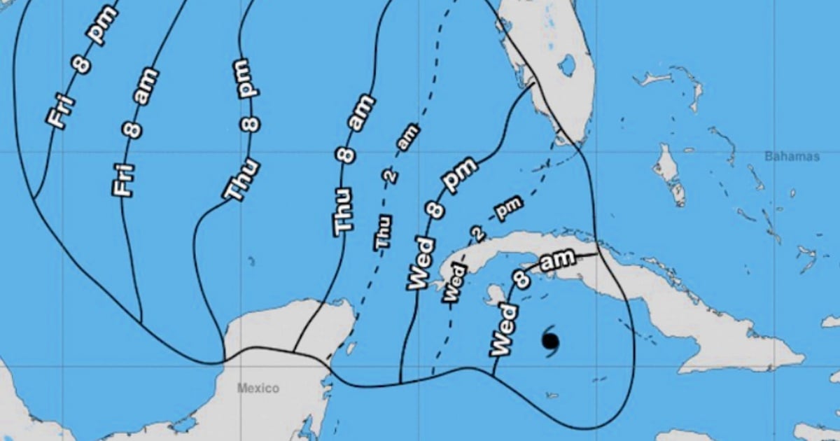
The National Civil Defense Staff has declared a Cyclone Alert Phase effective from 6 a.m. this Wednesday for eight Cuban provinces and the Isle of Youth as Hurricane Rafael, recently upgraded to a Category 2 on the Saffir-Simpson scale, approaches the island.
In its fourth informational note, dated 11 p.m. on November 5, Civil Defense announced the measure in anticipation of worsening weather conditions, including "heavy rains, showers, and thunderstorms expected to be strong and locally intense across the western and central regions, with rainfall accumulations between 100 and 200 millimeters within 24 hours."
The Cyclone Alert applies to the provinces of Villa Clara, Sancti Spíritus, Cienfuegos, Matanzas, Mayabeque, Havana, Artemisa, Pinar del Río, and the Special Municipality of the Isle of Youth. Meanwhile, the remaining seven provinces—Guantánamo, Santiago de Cuba, Holguín, Granma, Las Tunas, Camagüey, and Ciego de Ávila—remain under an Informative Phase.
Coastal Flooding and High Winds Expected
Civil Defense also warned of significant wave activity along the central and western southern coasts, predicting moderate to severe coastal flooding in the southern regions of Sancti Spíritus, Cienfuegos, Matanzas, Mayabeque, Artemisa, and Pinar del Río, as well as the Isle of Youth and the Canarreos archipelago.
The state entity advised residents to stay updated on the system's progress through national, provincial, and municipal media, as well as official social media channels, and to meticulously follow instructions issued by local authorities and Civil Defense.
Worsening Meteorological Conditions
The Institute of Meteorology (INSMET) issued a bulletin at 6 a.m. this Wednesday, forewarning a rapid deterioration of Cuba's weather conditions, a situation already confirmed by meteorological radar.
Overnight, intense rains, showers, and thunderstorms were reported in the eastern and central regions, with further intensification expected in the western area. Morning winds are forecasted to blow from the east to southeast in the west and central areas, reaching speeds of 50 to 65 km/h.
By afternoon, winds will shift to the southeast-south, with speeds escalating to 95 to 110 km/h and even stronger gusts. Near the center of this tropical system, winds will reach hurricane strength as it traverses the western region.
At 7 a.m., the hurricane's eye was located 140 kilometers east-southeast of the Isle of Youth and 260 kilometers south-southeast of Havana, Cuba, with maximum sustained winds of 160 km/h, moving northwest at 22 km/h.
Several Cuban meteorologists have taken to social media, urging the western population to brace for impact. Hurricane Rafael is projected to make landfall between Artemisa and Pinar del Río.
