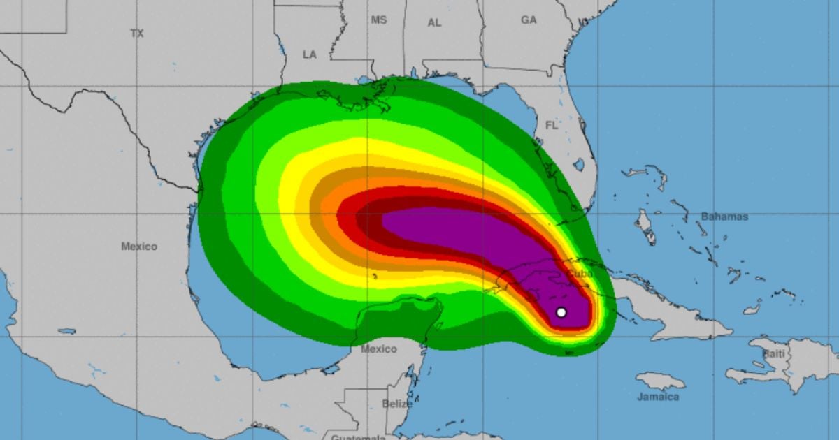
The Cuban Institute of Meteorology's Forecast Center issued a warning on Wednesday about Hurricane Rafael, which has intensified to a Category 3 on the Saffir-Simpson scale. The hurricane is heading toward Cuba with sustained winds of 115 miles per hour and is expected to strengthen further in the coming hours. According to the INSMET on social media, these wind speeds classify Rafael as a major Category 3 hurricane.
The approaching storm has already brought heavy rain, showers, and thunderstorms to the central region, which are expected to move westward. Rainfall accumulations are forecasted to range from 4 to 8 inches, with some areas possibly seeing even more. In Cayo Largo del Sur, wind gusts reached up to 84 mph, while Playa Girón in Matanzas experienced gusts of 48 mph.
As of midday, the hurricane's center was located roughly 25 miles east-northeast of Punta del Este on the Isla de la Juventud, and 68 miles south-southeast of Playa Cajío in Artemisa. Rafael is moving northwest at 14 mph and is expected to make landfall this afternoon between Guanimar in Artemisa and Dayaniguas in Pinar del Río. The system is predicted to reenter the sea later tonight between Puerto Esperanza in Pinar del Río and Bahía Honda in Artemisa.
In the coming hours, sustained winds between 43 and 53 mph are expected in western and central Cuba, with gusts potentially exceeding 93 mph in areas close to Rafael's center, particularly impacting the provinces of Artemisa and Pinar del Río. Significant storm surges are anticipated along the south-central and western coasts, with waves reaching up to 23 feet and potential coastal flooding in Sancti Spíritus, Cienfuegos, and Matanzas. The most severe conditions are forecasted for Mayabeque, Artemisa, Pinar del Río, the Isla de la Juventud, and the Canarreos Archipelago.
In response to Rafael's imminent arrival, the National Civil Defense has declared a Cyclonic Alarm Phase for eight Cuban provinces and the Isla de la Juventud as of 6:00 a.m. Wednesday. This decision, outlined in their fourth information bulletin dated November 5 at 11 p.m., was made in anticipation of worsening weather conditions, with rain, showers, and thunderstorms becoming strong and locally intense across the country's western and central regions, with rainfall totals between 4 and 8 inches within 24 hours.
