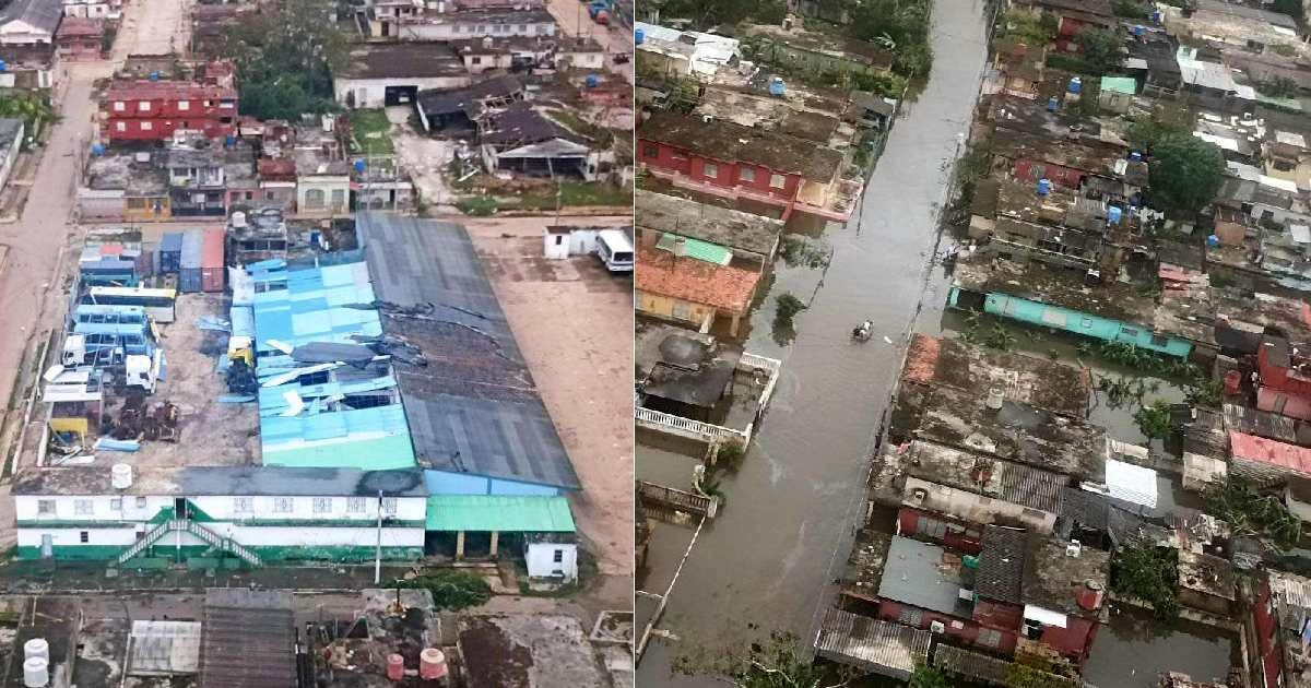
In a revealing release, the Cuban Ministry of the Armed Forces (FAR) shared aerial images highlighting the extensive destruction across several areas in Artemisa following the onslaught of Hurricane Rafael. The storm made its mark on the nation late Wednesday afternoon.
These images, posted on their official Facebook page, "MINFAR Cuba," portray a scene of devastation, particularly evident in the agricultural sector. Notable among the damages are the obliteration of crop houses, and severe impacts on the roofs of homes and government buildings.
Severe Agricultural Losses in Bauta and Beyond
In Bauta, the photos reveal significant coastal flooding and damaged farmlands. The report also indicates that San Antonio de los Baños suffered substantial losses in tobacco houses and banana plantations. In Güira de Melena, the fields are left in ruins.
Widespread Destruction in Ceiba del Agua
The community of Ceiba del Agua wasn't spared either, facing considerable damage. The hurricane made landfall around 4:20 p.m. on Wednesday as a Category 3 storm on the Saffir-Simpson scale and exited the country as a Category 2 by approximately 7:00 p.m., via the Bay of Cabañas in Artemisa.
Impact on Infrastructure and Community
The Cuban government reports that Artemisa is the hardest hit area, with severe repercussions on hospitals, schools, service centers, housing, roofing, and the electrical grid. Despite the extensive damage, which is still being assessed, authorities have not reported any casualties linked to the storm.
