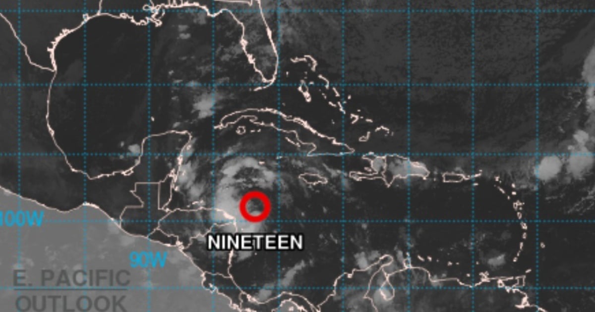
The early hours of today saw the formation of the 19th tropical depression of the current hurricane season, as reported by the National Hurricane Center (NHC) of the United States. It is anticipated that this weather system could transform into Tropical Storm Sara later today, gaining strength if it remains over water. This development raises concerns for areas that may be affected, including Honduras, Nicaragua, and other parts of Central America.
At 7:00 a.m., the center of the depression was positioned about 400 km east of Isla Guanaja, Honduras, and approximately 150 km northeast of Cabo Gracias a Dios, near the Honduras-Nicaragua border. The system is currently moving westward at 24 km/h (15 mph) with maximum sustained winds of 55 km/h (35 mph).
"This movement is expected to persist through today, carrying the system across the western Caribbean Sea. The depression is anticipated to stall and meander near the northern coast of Honduras by Friday night and continue through the weekend," warns the U.S. meteorological agency.
The latest advisory from the NHC cautions about heavy rainfall that could lead to flash floods and landslides in various parts of Honduras over the weekend. In its Tropical Cyclone Advisory No. 1, the Cuban Institute of Meteorology (INSMET) noted that "considering its current position, potential development, and time of year, the Forecast Center is closely monitoring its path in the coming days."
Current Alerts and Warnings
Several warnings and alerts are active in the region. A Hurricane Watch is in place from Punta Castilla to the Honduras-Nicaragua border, including the Bay Islands of Honduras. Additionally, a Tropical Storm Warning is issued from Punta Sal to the same border and for the Bay Islands. A Tropical Storm Watch is also in effect from the border to Puerto Cabezas, Nicaragua.
These alerts signify the potential for hurricane or tropical storm conditions in these areas within the next 48 hours, complicating outdoor preparations and increasing risk for residents. People in Honduras, Belize, and the Yucatán Peninsula are advised to closely track the progress of this system.
Regional Hazards
Rainfall: Authorities are forecasting rainfall totals of 10 to 20 inches in northern Honduras, with isolated maxima of up to 30 inches, posing a substantial risk of catastrophic flash flooding and landslides, especially in mountainous areas like the Sierra La Esperanza.
Elsewhere in Honduras, as well as in Belize, El Salvador, eastern Guatemala, and western Nicaragua, rainfall totals of 5 to 10 inches are expected, with possible peaks of up to 15 inches, which could lead to flooding and landslides.
Wind: Hurricane conditions are anticipated to reach the watch area by Friday. Areas under warning will experience tropical storm conditions today, while such effects are possible in the watch areas by the end of the day.
Storm Surge: The storm surge associated with this system could elevate sea levels by 1 to 3 feet above the usual tide along the northern coast of Honduras, creating large and potentially destructive waves in coastal regions.
