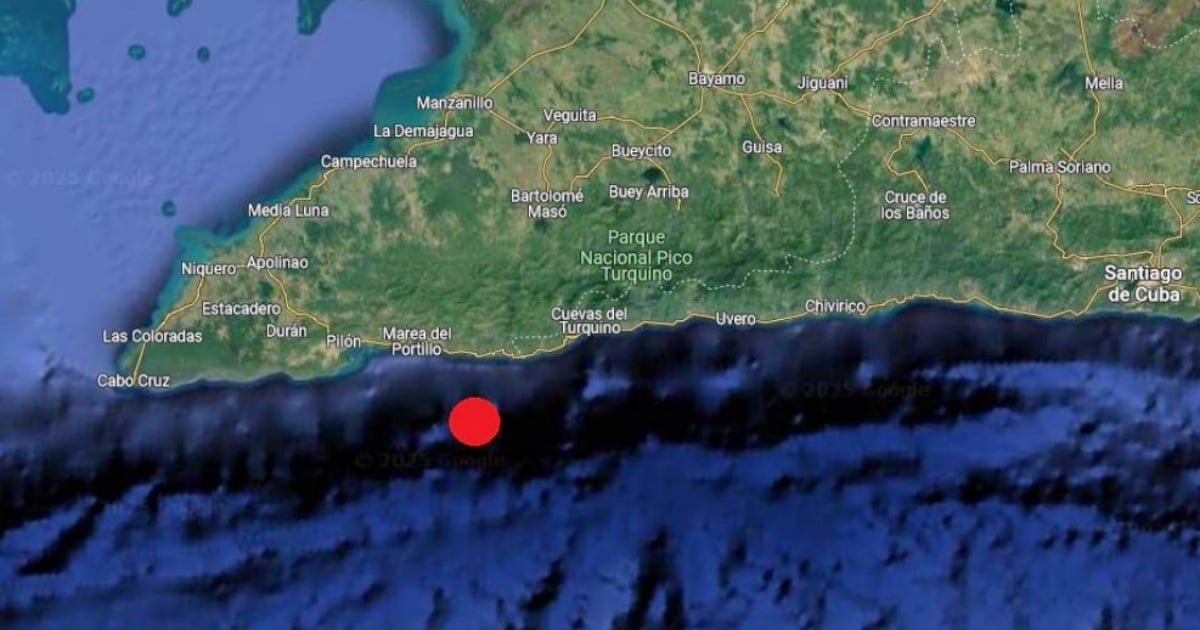
Enrique Diego Arango Arias, head of Cuba's National Seismological Service, announced that a noticeable tremor was detected by the country's seismic station network at 9:09 a.m. on March 7. This seismic event measured 2.9 in magnitude and occurred at a depth of 2.8 kilometers. The epicenter was pinpointed 26 kilometers southeast of Pilón, located in Granma province.
According to the data provided, the earthquake's coordinates were 19.755 degrees north latitude and -77.078 degrees west longitude. Reports indicated that the quake was felt in the municipalities of Pilón and Bartolomé Masó, both within the Granma region. As of this report, no material damage or injuries have been documented.
Prior to this incident, the last perceptible earthquake in Cuba was recorded in the early hours of February 25. The epicenter for that quake was situated 24 kilometers from Bartolomé Masó and 37 kilometers southeast of Pilón. It had a magnitude of 3.3 and was registered at a depth of 10 kilometers.
On the previous Sunday, Enrique Diego Arango emphasized the importance of continuous monitoring in the Caribbean region due to several seismic events occurring within a short span. In a Facebook post, he highlighted the potential danger of a major earthquake exceeding 7.5 in magnitude, which could trigger tsunami waves impacting the northern coast of eastern Cuba.
Arango stressed the necessity of tracking seismic activities, especially north of Hispaniola (Haiti and the Dominican Republic) and Puerto Rico, as these are areas of high seismic activity. His cautionary note came shortly after specialized media reported intense seismic activity near the subduction fault around the 19° North latitude, a region where tectonic plate interactions frequently cause significant quakes.
Such phenomena occur when one lithospheric plate descends beneath another, forming convergent boundaries that can lead to powerful earthquakes. The official state-run news outlet, Prensa Latina, reminded readers of a 7.6 magnitude earthquake on February 8 that struck the Caribbean Sea, prompting tsunami alerts across several countries in the region. Although these alerts were rescinded hours later, the event stirred concern in Cuba, with reports of tremor sensations from Cienfuegos to Pinar del Río, including the Isle of Youth.
Arango assured that no significant sea level changes were observed in that instance but maintained that seismic monitoring is crucial for public safety. Recently, the expert addressed rising concerns about a potential major earthquake in the Caribbean that could affect Cuba. He clarified that while certain regions with geological faults store a lot of energy and could produce significant tremors, predicting such events in the short term without concrete data is not feasible.
In the aftermath of the 6 and 6.7 magnitude earthquakes that struck southeastern Cuba on November 10 last year, ten individuals were injured, and at least 3,752 buildings sustained damage.
Understanding Seismic Activity in Cuba
Where was the epicenter of the latest earthquake in Cuba?
The epicenter was located 26 kilometers southeast of the municipality of Pilón in Granma province.
How did the authorities respond to the recent seismic activity?
Authorities emphasized the importance of continuous monitoring and highlighted the potential risks of significant earthquakes in the region.
What areas in the Caribbean are of particular concern for seismic activity?
Hispaniola, Haiti, the Dominican Republic, and Puerto Rico are areas with high seismic activity that require close observation.